Sony Playstation Portable is powerfull device for gaming, Sony PSP enhanced with strong graphics and processor for excelent graphics. Nintendo DS as Sony PSP rival is one step left behind. One advantage of Sony PSP is the ability to add gadgets. Sony PSP has abilty to take pictures with attached camera gadgets. Sony has officially announced the GPS peripheral for their product.
HARDWARE
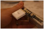
One GPS gadget is PSP-290. The PSP-290 GPS Receiver is fairly small. It attaches to the USB port on top of the PSP and is held in place with two screws. The antenna can be placed in several positions whether it be up or closed.
PSP GPS 290 Specifications:
- Product name: GPS receiver
- Model name: PSP-290
- Reception frequency: 1575.42Mhz (L1 band, C/A cord/code
- Reception method: Channel 20
- Reception sensitivity: Pursuit: - 153dBm
- Supplementation/Capture: - 140dBm
- Determination renewal time: Approximately 1 second
- Determination precision: 5m (2DRMS, - 130dBm)
- External size: Approximately 45 × 41 × 17mm (width x height x depth)
- Mass: Approximately 16g

GPS receiver for Sony (http://www.engadget.com).
GPS for PSP (Playstation Portable), launching may 2008 (US).
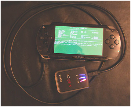
GPS receiver modified from external GPS holux (http://www.joystiq.com)
APPLICATIONS AND MAPS
1. Go!Explore
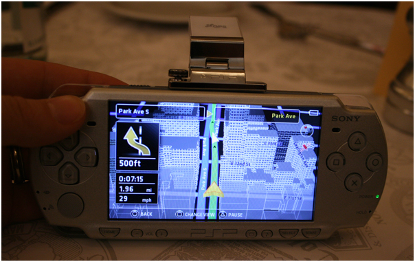
Go!Explore is GPS software for the PlayStation Portable based on Nav N Go iGO 8, covering several countries in Europe. It was developed by Nav N Go and utilizes maps by Tele Atlas. Sales of product started in March 2008.
Go!Explore works with Sony's PSP-290 GPS receiver, which connects to the USB port on the top of the unit. It supports 11 audio languages on every geographic version; English, German, French, Dutch, Spanish, Portuguese, Italian, Danish, Swedish, Norwegian, Finnish. (source: en.wikipedia.org)

Routing

3D

Menu

Routing

Routing

Small GPS receiver

GPS receiver

GPS Receiver

GPS Receiver
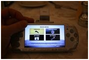
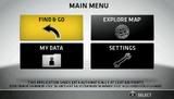
Menu
2. Map This! Application
Map This! Application (http://deniska.dcemu.co.uk) is open source software (homebrew) for GPS application's Sony PlayStation Portable. With GPS receiver attached, we can see our position on the map, but without GPS attache, Map This! can be used as map viewer. Using Deniska's MapThis! app, it takes about anywhere from 30 seconds to a couple of minutes for the GPS Receiver to lock on to some satellites depending on your location. (http://en.wikibooks.org/wiki/Map_This!).
3. Maps
Map from Tele Atlas (http://gizmodo.com).
PRICE ?
Price from http://www.consoleshop.com/home.php?cat=282 Price: $74.95 (€ 52.46)
Price in Indonesia Rp560.000 http://www.tukanggame.com
REFERENCE
http://www.jp.playstation.com
Comments